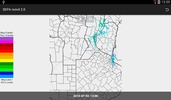
SepaMovil is an innovative Android app that delivers detailed geographical and environmental data specifically for regions within Argentina. Its main purpose is to provide users with valuable insights into climatic, topographic, soil, and vegetation indexes based on their current geographic location.
Comprehensive Climate Data
One of the primary features of SepaMovil is its ability to offer extensive climate information. Users can effortlessly access precipitation analytics for the past week and month, learn about maximum and minimum shelter temperatures from the last seven days, and locate the proximity and direction of the nearest INTA weather station. Additionally, SepaMovil provides accumulated precipitation and average temperature graphs spanning the past six months, utilizing data from the INTA meteorological network.
Advanced Topography and Soil Features
For those interested in the topography and soil characteristics of their location, SepaMovil offers detailed information on the current height above sea level, slope direction, and soil type. By tapping into the resources of the INTA soil atlas, users can delve into detailed soil attributes, including composition, limitations, and key characteristics. This makes it an indispensable tool for understanding the land's fundamentals.
Vegetation Indexes and Historical Comparison
Vegetation enthusiasts will appreciate the app’s ability to display current campaign vegetation indexes, along with historical comparisons of maximum, minimum, and average values since 2000, all sourced from the MODIS remote sensor. This feature ensures users stay informed about vegetation trends and their development over time.
SepaMovil stands out as a crucial resource for anyone interested in comprehensive environmental data, providing a robust suite of tools to better understand the natural world in Argentina.
Requirements (Latest version)
- Android 4.1, 4.1.1 or higher required


Comments
Excellent